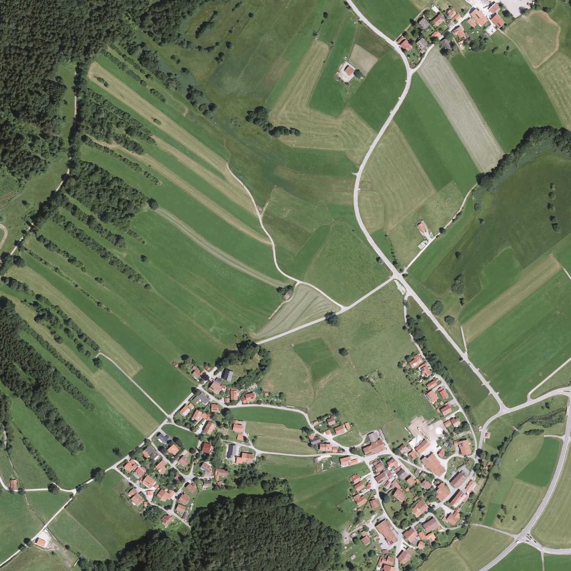
View of a digital orthophoto from the Bavarian Survey Administration. The image is a rectified, scaled aerial photo based on the Bavarian survey. The dimensions of this image are 1km × 1km. One pixel edge is 40cm long. The coordinate system used is UTM32, or EPSG:25832. This file is the original TIF file from the Bavarian Survey Administration and is called GEOTIFF. The graphics are updated in batches, but should be considered current. The DOP40 images from the Bavarian Survey Administration are copyrighted, OpenData, and usable under the terms of the CC-BY 4.0 license. This section shows a part of the district of Traunstein from above. – Bayerische Vermessungsverwaltung – www.geodaten.bayern.de, cc by – Wikimedia Commons Die Weitwiesstraße in Schleching ist eine asphaltierte Wohnstraße (50 km/h). Die Straße verfügt über keine Gehwege sowie eine Fahrbahnbreite von 3.5 m. Diese Straße liegt an der Wanderweg „Grenzenlos Wanderweg (Sachrang - Kössen - Prien)" sowie der Fahrradroute „Achentalradweg 🔗". Die nächste Haltestelle in der Nähe ist Abzw. Raiten (ca. 350 m entfernt).
🍽️ Rait'ner Wirt ist ein Restaurant 🌐 – ca. 300 m 🗺.
🍽️ Restaurant Geigelstein ist ein Restaurant (Bavarian, mit Außenbereich, rollstuhlgerecht) 🌐 – ca. 3600 m 🗺.
🍽️ Gasthof zur Post ist ein Restaurant (Bavarian, rollstuhlgerecht) – ca. 3700 m 🗺.
🍽️ Raggio Di Sole ist ein Restaurant (Pizza, rollstuhlgerecht) – ca. 4000 m 🗺.
Kioske in Schleching
🏪 Kiosk ist ein Kiosk (Öffnungszeiten: 8:30–11 Uhr; 15–18 Uhr) – ca. 1700 m 🗺.
Getränkemärkte in Schleching
📍 Getränkemarkt Mettenham ist ein Getränkemarkt – ca. 2000 m 🗺.
📍 Getränke Huber ist ein Getränkemarkt – ca. 3800 m 🗺.
Eisdielen in Schleching
🍦 Eis-Straßenverkauf Gasthof Zellerwand ist eine Eisdiele – ca. 2000 m 🗺.
Aussichtspunkte in Schleching
🔭 Teufelsstein ist ein Aussichtspunkt – ca. 2300 m 🗺.
🔭 Auerhahnwandlblick ist ein Aussichtspunkt – ca. 2600 m 🗺.
🔭 Vogelschau ist ein Aussichtspunkt – ca. 3300 m 🗺.
Touristeninformationen in Schleching
ℹ️ Brunstspitz ist eine Touristeninformation – ca. 2600 m 🗺.
ℹ️ Ramsensteig oben ist eine Touristeninformation – ca. 2900 m 🗺.
ℹ️ Felsenkeller in Mühlau am Mühlberg ist eine Touristeninformation. Informationstafel zur Geschichte dieses Platzes als Steinbruch, Kegelbahn usw. – ca. 3200 m 🗺.
ℹ️ Infotafel ist eine Touristeninformation – ca. 4000 m 🗺.
Feuerwachen in Schleching
🚒 Freiwillige Feuerwehr Schleching ist eine Feuerwache in der Kampenwandstraße 11 (83259) – ca. 2900 m 🗺.
Ferienwohnungen in Schleching
🏠 Ferienwohnung Hochplatte ist eine Ferienwohnung (eingeschränkt rollstuhlgerecht) (83259) 🌐 – ca. 3000 m 🗺.
Cafés in Schleching
☕ Café im Wuhrsteinhaus ist ein Café (Frühstück, Brotzeit, Regionale produkte, WLAN) in der Dalsenstraße 7 (83259) 🌐 – ca. 3100 m 🗺.

 Normale Karte
 ÖPNV-Stadtplan Schleching Legende
  Fahrradstadtplan Schleching Legende
  Fußgängerstadtplan Schleching Legende