
Zur Schwale in Bönebüttel
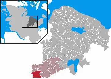
Zur Schwale in Bönebüttel ist eine Wohnstraße (30 km/h). Die nächste Bushaltestelle in der Nähe ist Bönebüttel, Dorf (ca. 150 m entfernt).
- Straßentyp
- Wohnstraße
- Höchstgeschwindigkeit
- 30
Bild
Bushaltestellen
Straßen in der Umgebung
Bönebütteler Ring100 m
Parkplatz KiTaKiTa Bönebüttel
150 m
Bönebütteler DammBönebüttel Siedlung, Bönebüttel, Tasdorfer Weg, Bönebüttel, Bönebüttel, Dorf
350 m
Mühlenblöcken400 m
Mövenwischredder650 m
Wedelweg700 m
Alter Schulsteig850 m
Sickkampredder900 m
Wieselweg950 m
SickfurtBönebüttel, Kummerfelder Weg
950 m
Fasanenweg950 m
Tasdorfer Weg1000 m
Wittenfördener Weg1000 m
Sainredder1,0 km
Marderweg1,1 km
Dachsweg1,1 km
Iltisweg1,1 km
HasenredderMartinskapelle, Freiwillige Feuerwehr Bönebüttel-Husberg
1,2 km
Sickkamp1,2 km
Kirchkamp1,3 km
Harderkamp1,3 km
Fuchsweg1,3 km
Dorfstraße1,3 km
Gartengrund1,4 km
Sandweg1,4 km
Plöner ChausseeHusberg, Harderkamp, Husberg, Husberg, Dorfstraße
1,4 km
Hans-Siem-Weg1,4 km
Zum Bruch1,5 km
Bogenweg1,6 km
Hohenbergskamp1,6 km
Holzweg1,6 km
Kummerfelder WegBönebüttel, Kummerfelder Weg
1,6 km
Kirchsteig1,6 km
Gadelander Weg1,6 km
Teichredder1,6 km
Bauernhöfe in der Umgebung
Brammerhof1,1 km
Bäche in der Umgebung
Schwale250 m
Geilenbek650 m
Brammerau900 m
Dorfwiesen in der Umgebung
Heinrich-Eigenwald-Platz1,5 km
Einzelhandelsgebäude in der Umgebung
Friseur750 m
Feuerwachen in der Umgebung
KiTa Nesthäckchen150 m
Gebäude in der Umgebung
Containerdienst Claus Banck100 m
Tischlerei Voigtländer100 m
Schwalehof150 m
KiTa Bönebüttel200 m
Gemeinde Bönebüttel, SV Bönebüttel Husberg1,1 km
Windmühle Elfriede1,4 km
Restaurants in der Umgebung
Büttler's Hus1,1 km
 ÖPNV-Stadtplan Bönebüttel Legende
 | Bahn | |
| Bus | |
| Straßenbahn |
 Fahrradstadtplan Bönebüttel Legende
 | Radweg | |
| Fahrradspur auf der Fahrbahn | |
| Radfahren auf der Busspur | |
| Fahrradstraße | |
| Für Radfahrer frei | |
| Für Radfahrer frei, guter Weg | |
| Radfahren verboten | |
| Kopfsteinpflaster |
| Fernradweg | (je nach Maßstab) | |
| Fernradweg |
 Fußgängerstadtplan Bönebüttel Legende
 | Pfad |
| Fernwanderweg | (je nach Maßstab) | |
| Fernwanderweg | ||
| Fußgänger verboten |