
Am Larmbarg in Roggenstorf
Am Larmbarg in Roggenstorf ist eine Wohnstraße. Am Larmbarg verläuft in Nord-Süd-Richtung und endet an der Moorer Straße, während das andere Ende eine Sackgasse ist. Die nächste Haltestelle in der Nähe ist Roggenstorf (ca. 350 m entfernt).
- Straßentyp
- Wohnstraße
- Verlauf
- Nord-Süd
Bild
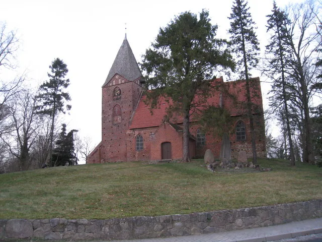
Autowerkstätten
Bushaltestellen
Straßen in der Umgebung
Hafweg250 m
Moorer Straße300 m
Luise-Reuter-StraßeRoggenstorf
300 m
Fritz-Reuter-StraßeRoggenstorf
950 m
Zur Mühle1,3 km
Welziner StraßeGrevenstein
1,7 km
Am Langen LenzenPohnstorf
1,8 km
FeldmarkGrevenstein Feldmark, Beisendorf
1,9 km
GrevensteinGrevenstein
1,9 km
Am Gallberg2,3 km
Am HofGroß Voigtshagen, Groß Voigtshagen Dorf
2,4 km
Neu GreschendorfNeu Greschendorf
2,4 km
Zur Büdnerei2,5 km
Bädlingshof2,6 km
Alter Ring2,7 km
Wiesenweg2,8 km
Am Großen Moor2,8 km
Am Schloßteich2,8 km
Dorfstraße2,9 km
HauptstraßeTramm
3,0 km
Ringstraße3,0 km
Lübecker StraßeGasthaus Luisenhof, Mittelalterlicher Gedenkstein
3,1 km
Dassower StraßeRankendorf
3,1 km
WeidenringMallentin Greschendorfer Weg
3,2 km
Kalkhorster Weg3,2 km
Gartenstraße3,3 km
Birkeneck3,3 km
Alte DorfstraßeMallentin
3,4 km
Grevesmühlener StraßeMitsubishi, Freiwillige Feuerwehr Mallentin, Skoda - Auto-Treff-Mallentin, Schmachthagen
3,5 km
JägerhofJägerhof Ostsee, Jagdschule
3,5 km
Mummendorfer Straße3,6 km
Berg- und Tal-Straße3,7 km
Rankendorfer StraßeGroß Voigtshagen Abzweig, Klein Voigtshagen
3,7 km
Moorer Weg4,0 km
Roxin AusbauZoltáns Hof, Burganlage Roxin
4,0 km
Bauernhöfe in der Umgebung
Hof Sangel1,2 km
Hühnerhof Sangel1,9 km
Ferienhäuser in der Umgebung
Altes Schäferhaus2,9 km
Gebäude in der Umgebung
Luise-Reuter-Haus200 m
Gutshaus Rankendorf2,7 km
Speckturm3,2 km
Chausseehaus Mallentin3,5 km
Gutshaus Klein Voigtshagen3,6 km
Gotteshäuser in der Umgebung
Dorfkirche Roggenstorf400 m
Gräben in der Umgebung
Trammer Beek1,5 km
Häuser in der Umgebung
Ev.-Luth. Jakobus-Kirchengemeinde Roggenstorf450 m
Wälder in der Umgebung
Moorer Busch3,4 km
Sonstiges in der Umgebung
Zufahrt Aufbau2,1 km
Eingang2,1 km
 ÖPNV-Stadtplan Roggenstorf Legende
| Bahn | |
| Bus | |
| Straßenbahn |
 Fahrradstadtplan Roggenstorf Legende
| Radweg | |
| Fahrradspur auf der Fahrbahn | |
| Radfahren auf der Busspur | |
| Fahrradstraße | |
| Für Radfahrer frei | |
| Für Radfahrer frei, guter Weg | |
| Radfahren verboten | |
| Kopfsteinpflaster |
| Fernradweg | (je nach Maßstab) | |
| Fernradweg |
 Fußgängerstadtplan Roggenstorf Legende
| Pfad |
| Fernwanderweg | (je nach Maßstab) | |
| Fernwanderweg | ||
| Fußgänger verboten |