
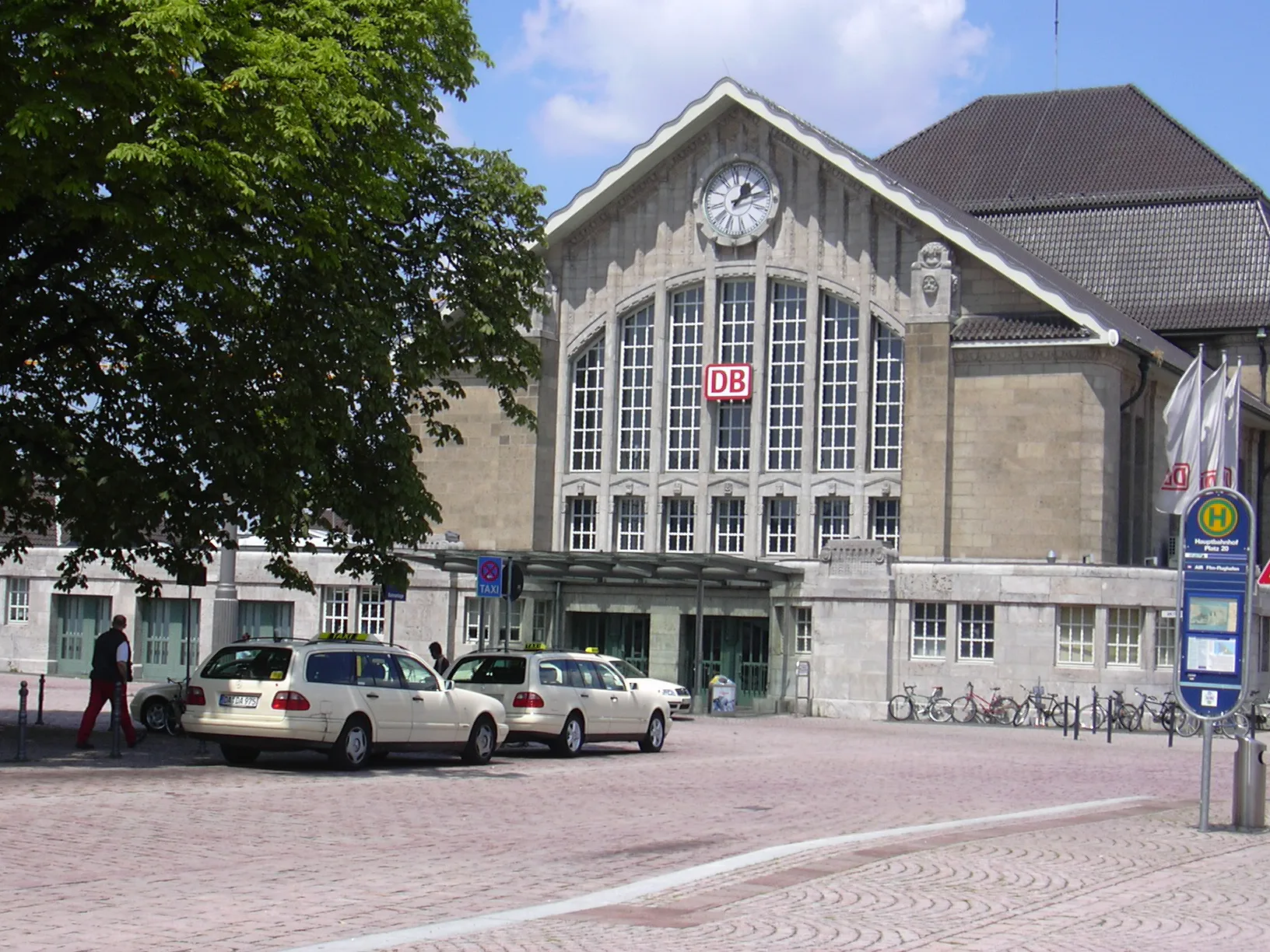
Bahnhofsplatz in Darmstadt-Nord
Der Bahnhofsplatz in Darmstadt ist eine gepflasterte, beleuchtete Fußgängerzone. In der Umgebung befinden sich unter anderem ein Fahrradverleih, eine Bar, eine öffentliche Toilette und eine Bäckerei. Die nächsten Haltestellen sind Hauptbahnhof und Darmstadt Hauptbahnhof.
- Fahrrad
- ja
- Straßentyp
- Fußgängerzone
Bild
Fotoautomaten
Fahrradverleihe
Öffentliche Toiletten
Bahnsteige
Bars
Straßenbahnhaltestellen
Bäckereien
Straßen in der Umgebung
Hauptbahnhof Platz 4Hauptbahnhof, Umgebungsplan
50 m
Am FürstenbahnhofKarlson, Hauptbahnhof, Call a Bike Station Darmstadt Hbf
50 m
Hauptbahnhof Platz 20Hauptbahnhof
50 m
Am HauptbahnhofHauptbahnhof, Restaurant
50 m
Hauptbahnhof Platz 11Hauptbahnhof
100 m
Hauptbahnhof Platz 19Hauptbahnhof
100 m
Hauptbahnhof Platz 2Gorenshi, Hauptbahnhof
100 m
Hauptbahnhof Platz 12Hauptbahnhof
100 m
Hauptbahnhof Platz 13Hauptbahnhof
150 m
Hauptbahnhof Platz 17/18Hauptbahnhof Platz 17/18
150 m
Hauptbahnhof Platz 16Hauptbahnhof, Klause, Klausenweg - Terra Preta
150 m
Hauptbahnhof Platz 5Hauptbahnhof
150 m
Hauptbahnhof Platz 15Hauptbahnhof, Klausenweg - Biodiversität, Klausenweg - Entstehendes Wegenerz
150 m
Hauptbahnhof Platz 14Hauptbahnhof
150 m
KülpstraßeHauptbahnhof
150 m
GoebelstraßeBraustübl, Ersatzhaltestelle Hauptbahnhof, vinocentral, Molina's GranConsumo
200 m
PoststraßePostamt, Hauptpostamt, Darmstadt Hauptbahnhof
200 m
Hauptbahnhof Bussteig 21250 m
ZweifalltorwegHauptbahnhof Bushalt 22, Hauptbahnhof Bushalt 21, Darmstadt Hauptbahnhof, Missing Link and Ziggy's, Hauptbahnhof Fernbusse, Fernbusse Darmstadt
250 m
Schachtstraße250 m
Hauptbahnhof Bussteig 22250 m
Lise-Meitner-StraßeHauptbahnhof West, ISOCollect, efacec, Packstation 132, Europaviertel
300 m
EuropaplatzReibold, Fahrbibliothek, Haltestelle Europaviertel
300 m
Bratustraße350 m
RheinstraßeBackshop, Sparkasse, Synästhetischer Raumkörper, Gusseiserner Sockel eines Kandelabers, Deutsche-Telekom-Allee (außer Betrieb), Maritim Sky Bar, Aral, Aral SuperWash
350 m
Pfalzweg316
400 m
Bahnhöfe in der Umgebung
Fürstenbahnhof100 m
Bahnsteige in der Umgebung
Gleise 3+4100 m
Gleise 7+8150 m
Gleise 11+12200 m
Gleise 9+10200 m
Gleise 5+6200 m
Eisenbahnstrecken in der Umgebung
Main-Neckar-Bahn150 m
Geschäftsgebäude in der Umgebung
Europa Arkaden300 m
Connect300 m
Haltestellen in der Umgebung
Hauptbahnhof Platz 150 m
Hotels in der Umgebung
IntercityHotel Darmstadt150 m
Maritim - Konferenzhotel250 m
B&B Hotel300 m
Mehrfamilienhäuser in der Umgebung
Philox300 m
Parkplätze in der Umgebung
Parkhaus P&R Darmstadt250 m
Parks in der Umgebung
Platz der Deutschen Einheit100 m
Polizeidienststellen in der Umgebung
Bundespolizei150 m
Sehenswürdigkeiten in der Umgebung
Mozartturm350 m
Straßenbahnhaltestellen in der Umgebung
Hauptbahnhof Platz 3100 m
TZ Rhein Main350 m
Touristeninformationen in der Umgebung
DB Information50 m
Mobilitätszentrale100 m
Wohnheime in der Umgebung
Studierendenwohnheim Poststraße200 m
 ÖPNV-Stadtplan Darmstadt-Nord Legende
 | Bahn | |
| Bus | |
| Straßenbahn |
 Fahrradstadtplan Darmstadt-Nord Legende
 | Radweg | |
| Fahrradspur auf der Fahrbahn | |
| Radfahren auf der Busspur | |
| Fahrradstraße | |
| Für Radfahrer frei | |
| Für Radfahrer frei, guter Weg | |
| Radfahren verboten | |
| Kopfsteinpflaster |
| Fernradweg | (je nach Maßstab) | |
| Fernradweg |
 Fußgängerstadtplan Darmstadt-Nord Legende
 | Pfad |
| Fernwanderweg | (je nach Maßstab) | |
| Fernwanderweg | ||
| Fußgänger verboten |