
Pidinger Steg in Bad Reichenhall
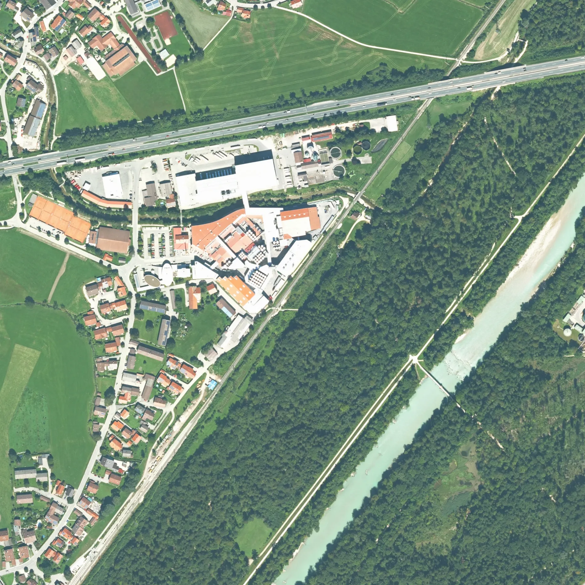
Pidinger Steg in Bad Reichenhall ist ein Pfad. Diese Straße liegt an den Fahrradrouten Salzhandelsweg 🔗, Bodensee-Königssee-Radweg 🔗 und Salinenradweg 🔗 sowie der Mountainbike-Route „Watzmann-Hochkönig Nord-Runde: Etappe 4: Ruhpolding – Marzoll". In der Umgebung befindet sich eine Touristeninformation. Die nächste Haltestelle in der Nähe ist Bad Reichnehall Abzw. Schwarzbach (ca. 400 m entfernt).
- Fahrrad
- ausgewiesen
- Straßentyp
- Pfad
Bild
Touristeninformationen
Straßen in der Umgebung
Saalachstraße400 m
DammwegStadtplan, Saalacherlebniswelt, Schloss Staufeneck
450 m
Reichenhaller StraßeBad Reichnehall Abzw. Schwarzbach, Shell, Bad Reichenhall Weißbach Brücke, Bad Reichenhall Marzoll/Türk, Bad Reichenhall Abzw. Schwarzbach
500 m
Haidergasse550 m
Marzoller Weg550 m
HockerfeldBergbauern als Naturschützer
550 m
Am GänslehenMilchladen
600 m
Achendammweg650 m
Am GoringSchwarzbach
650 m
UntersbergstraßeTürk Ort, Türk
750 m
Heimfeld750 m
An der SchanzSchwarzbach Ort
750 m
RainthalstraßeSchwarzbach Ort, Schwarzbach Schwimmbad, Türk Ort, Stadtplan
800 m
Haindlstraße800 m
Lena-Christ-Straße850 m
Moosbachstraße900 m
RoseggerstraßeParkplatz Lohmayr Stub'n
900 m
Am Kreuzweg900 m
Kohlerbachstraße950 m
Antiquitätengeschäfte in der Umgebung
Antik Wrede650 m
Bäche in der Umgebung
Aubach200 m
Wasserbach450 m
Kohlerbach750 m
Schwarzbach1,0 km
Flüsse in der Umgebung
Pidinger Ache900 m
Gartencenter in der Umgebung
Gärtnerei Friedl800 m
Gebäude in der Umgebung
Stellwerk Piding400 m
Ehemaliger Gasthof Roider550 m
Station Schwarzbach600 m
Schlachthof650 m
Lehrbienenstand700 m
Station Lena-Christstr.750 m
Station Untersbergstraße800 m
Station Rainthal800 m
Station Türk850 m
Gemischtwarenläden in der Umgebung
Marzoller Kramerladen850 m
Industriegebäude in der Umgebung
Milchwerke Berchtesgadener Land400 m
Höglauer Güterverkehr600 m
Kindergärten in der Umgebung
Gemeinde Kindergarten Piding750 m
Pensionen in der Umgebung
Gästehaus Scheil Apartments750 m
Schwimmbäder in der Umgebung
Kinderbecken700 m
Babybecken700 m
Sehenswürdigkeiten in der Umgebung
Almhütte600 m
Spielplätze in der Umgebung
Wasserspielplatz600 m
Spielplatz im bachei700 m
Sportplätze in der Umgebung
Beachvolleyball Piding750 m
SV Marzoll800 m
Wasserparks in der Umgebung
Mein Bachei - Alpinbad Schwarzbach650 m
Sonstiges in der Umgebung
Kläranlage Bad Reichenhall500 m
 ÖPNV-Stadtplan Bad Reichenhall Legende
 | Bahn | |
| Bus | |
| Straßenbahn |
 Fahrradstadtplan Bad Reichenhall Legende
 | Radweg | |
| Fahrradspur auf der Fahrbahn | |
| Radfahren auf der Busspur | |
| Fahrradstraße | |
| Für Radfahrer frei | |
| Für Radfahrer frei, guter Weg | |
| Radfahren verboten | |
| Kopfsteinpflaster |
| Fernradweg | (je nach Maßstab) | |
| Fernradweg |
 Fußgängerstadtplan Bad Reichenhall Legende
 | Pfad |
| Fernwanderweg | (je nach Maßstab) | |
| Fernwanderweg | ||
| Fußgänger verboten |